

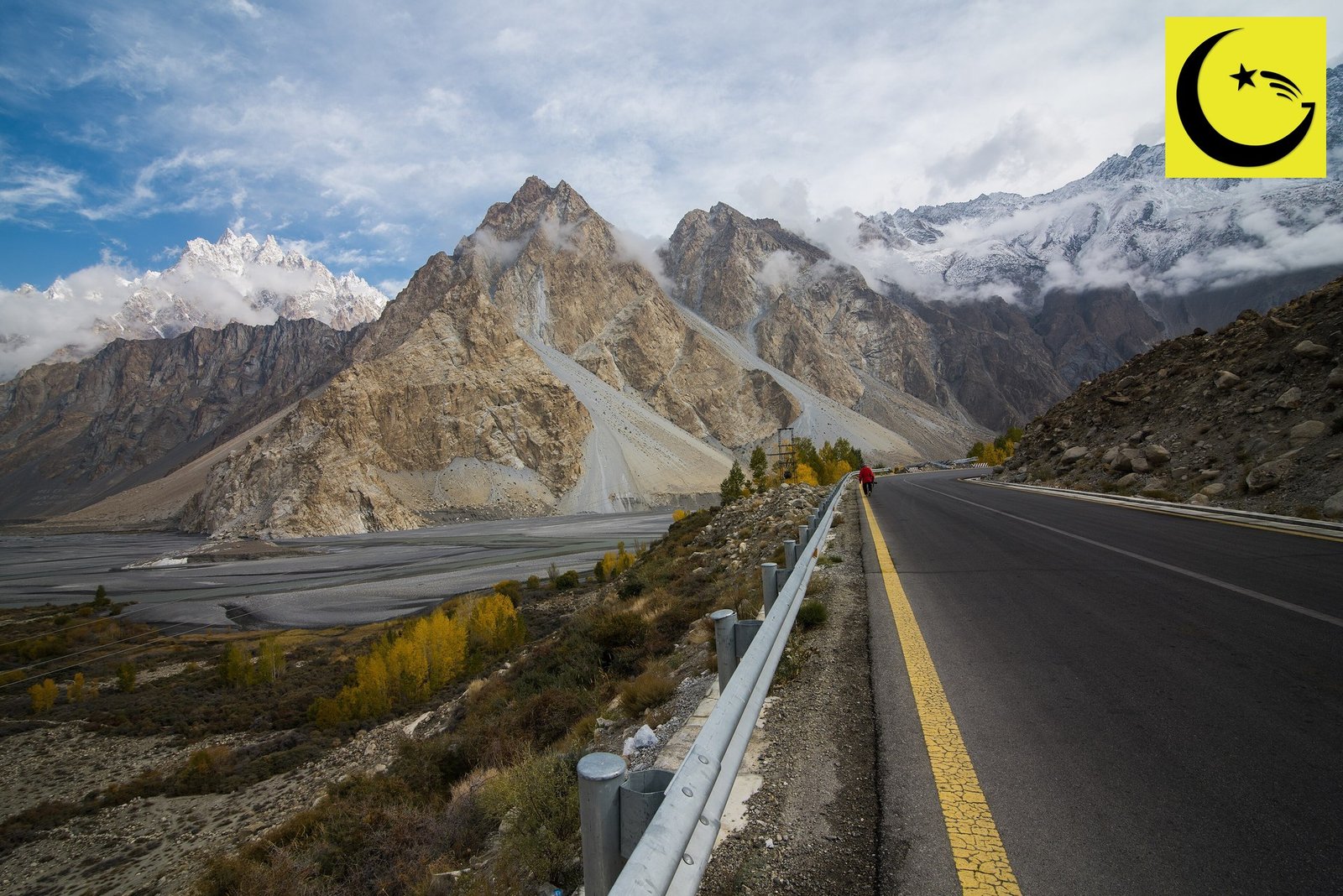
The Karakoram Highway is the highest paved international road in the world, a mountain highway of about 1,300 kilometres that links Kashgar in China with Abbottabad in Pakistan. About 806 kilometres run through Pakistan and about 494 kilometres through China, and at its highest point the road crosses the Khunjerab Pass at 4,693 metres (15,397 ft) above sea level. Built jointly by Pakistan and China between 1966 and 1986, and opened in 1986, it is also known as the China-Pakistan Friendship Highway, and in Pakistan as National Highway 35, or N-35.
The Karakoram Highway record: a paved road at 4,693 metres
No other paved road that crosses an international border climbs as high as this one. Plenty of mountain roads are steep, and a few unpaved tracks go higher, but a fully paved, two-country highway that carries trucks, buses and cars over a pass at 4,693 metres stands alone. That is the record at the heart of this series, and it has stood since the road opened.
The scale is hard to take in from a map. The highway follows an old branch of the Silk Road, threading gorges cut by the Indus and Hunza rivers, passing glaciers that reach down almost to the tarmac, and climbing through three great mountain ranges at once: the Karakoram, the Himalaya and the Hindu Kush all meet along its route. Drivers like to call it the Eighth Wonder of the World, and for once the nickname feels earned rather than generous.
From Abbottabad to Gilgit: the long climb north
The journey north begins in the green hills of Hazara. From Abbottabad the road runs through Mansehra and the Kaghan foothills to Thakot, where it meets the Indus, and then follows the river into some of the deepest gorges on Earth. Around Chilas, on a clear morning, travellers get one of the great roadside views in Asia: Nanga Parbat, the ninth highest mountain in the world at 8,126 metres, filling the sky to the south.
Further north the road reaches Gilgit, the capital of Gilgit-Baltistan and the highway’s natural halfway house. Gilgit is where the valley widens, where the Gilgit River joins the Hunza River, and where roads branch off towards Skardu and the valleys of Ghizer. For most travellers it is the place to sleep, refuel and feel the mountains close in again before the climb into Nagar and Hunza.
READ MORE
The World’s Highest ATM: Ten Years of Cash in the Clouds at Khunjerab Pass
Twenty years of building through solid rock
Construction ran from 1966 to 1986, twenty years of blasting, drilling and digging through some of the most unstable ground on the planet. Pakistani engineers and soldiers of the Frontier Works Organisation worked alongside Chinese road builders, cutting ledges into cliff faces high above the Indus, bridging side valleys and holding back slopes that wanted to slide with every freeze, thaw and earthquake tremor.
The human cost was severe. Hundreds of Pakistani and Chinese workers lost their lives building this road, most of them in landslides and falls, and memorials along the route, including the Chinese cemetery in Gilgit where many Chinese builders are buried, still stop travellers today. The highway is a working road, but it is also a shared memorial, and both countries treat it that way.
Keeping it open remains a daily contest with the mountains. Landslides, floods and rockfalls close sections most years, and maintenance crews work through the seasons to clear them. Anyone who drives the full route understands quickly that the road was not built once and finished: it is rebuilt, in pieces, every year.
Hunza, Nagar and the lake that moved the road
North of Gilgit the highway enters Nagar and then Hunza, the stretch most visitors remember for the rest of their lives. At the Rakaposhi viewpoint the road passes beneath the 7,788 metre wall of Rakaposhi, one of the most beautiful mountains on Earth, rising almost 6,000 metres straight from the valley floor. Karimabad, with its ancient Baltit and Altit forts, sits above the road, and the valley’s apricot orchards and terraced fields line the route in spring blossom and autumn gold.
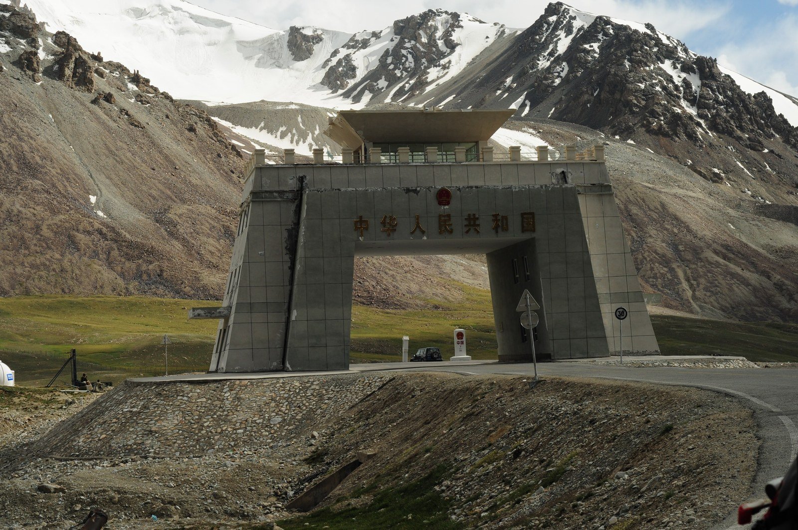
The border gate at Khunjerab Pass, where the highway crosses from Pakistan into China at 4,693 metres.
Photo: Irfan karim, CC BY-SA 4.0, via Wikimedia Commons
Beyond Hunza the road meets Attabad Lake, the turquoise lake created in January 2010 when a huge landslide dammed the Hunza River and drowned a long section of the original highway. For five years, vehicles crossed the lake by boat. In September 2015 a realigned 24 kilometre section opened, carrying the road around and through the mountainside in five tunnels known as the Pakistan-China Friendship Tunnels, about seven kilometres of tunnels in total, restoring the through route to China.
Past the lake the road climbs through Passu, beneath the jagged Passu Cones, and on to Sost, the last town in Pakistan and its dry port and customs post for trade with China. From Sost the final climb begins, through the high pastures of Khunjerab National Park, home to Marco Polo sheep and snow leopards, up to the top of the world road.
READ MORE
Arooj Aftab: The First Pakistani Woman to Win a Grammy
At the top: Khunjerab Pass and the road into China
The Khunjerab Pass, at 4,693 metres, is the highest point of the Karakoram Highway and the highest paved border crossing on Earth. The air holds about half the oxygen of the plains, engines labour, and travellers walk slowly between the border gate and the viewpoints for their photographs at the roof of Pakistan. The crossing is open seasonally, roughly from May to November, when snow and winter cold allow the pass to operate.
The pass has stories of its own. A short walk from the gate stands a National Bank of Pakistan cash machine that holds the Guinness record as the world’s highest ATM, a companion record in this series. Beyond the gate, the road descends on the Chinese side towards Tashkurgan and Kashgar, the old Silk Road city where the journey that began in Abbottabad ends about 1,300 kilometres later.
A friendship highway that still carries trade today
The road was built as an act of friendship, and it still works as one. Trucks carry Pakistani goods north and Chinese goods south through Sost dry port, and the highway forms the northern spine of the China-Pakistan Economic Corridor, the route that links Kashgar overland to Pakistan’s ports. Upgrades under that programme have resurfaced and widened long sections, and the Attabad tunnels showed the partnership still building together decades after the first crews met in the mountains.
It is also one of the world’s great tourist roads. Cyclists ride it end to end, motorcyclists climb it in convoys every summer, and the valleys it opened up, Hunza above all, now welcome visitors from across Pakistan and around the world. Guesthouses, cafes and guide companies along the route earn their living from a road that was built for strategy and trade and became, almost by accident, a journey people dream about.
Forty years after it opened, the highway remains what it was on the first day: the highest paved international road in the world, a Pakistan-China achievement written in asphalt across the Karakoram. More of the country’s records, rankings and world standings are collected on our Pakistan World Rankings and Records page.
Sources
- Karakoram Highway route, length and history: Karakoram Highway, Wikipedia
- Dawn: Attabad road link with China restored (15 September 2015, on the 24 km realignment and the Pakistan-China Friendship Tunnels)
- The Express Tribune: PM inaugurates KKH realignment project (15 September 2015)
- Featured image: Photo: mhtoori, CC BY-SA 4.0, via Wikimedia Commons
- In-body image: Photo: Irfan karim, CC BY-SA 4.0, via Wikimedia Commons

Umar Farooq is the founder and editor of Good News Pakistan. An engineer by profession and a writer by passion, he started the site in December 2022 to share good news from Pakistan, and has since written and edited more than 200 articles about its people, sports, science, business and world records. He believes the story of Pakistan is bigger than its headlines, and that good news, told honestly, is worth telling every day.